
Ipê topographic map
Click on the map to display elevation.
About this map
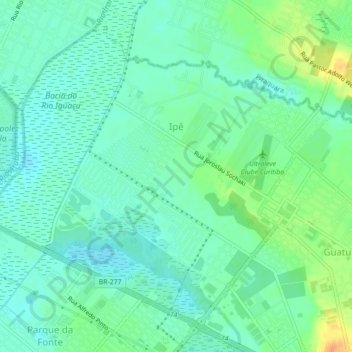
Name: Ipê topographic map, elevation, terrain.
Average elevation: 879 m
Minimum elevation: 867 m
Maximum elevation: 905 m
Other topographic maps
Click on a map to view its topography, its elevation and its terrain.
Rio Itaqui
Brasil > Paraná > Região Metropolitana de Curitiba > São José dos Pinhais
Average elevation: 891 m
São José dos Pinhais
Brasil > Paraná > Região Metropolitana de Curitiba > São José dos Pinhais
A altitude é de 906 metros, na sede municipal. O relevo do município é formado pelo talvegue do Iguaçu a oeste e pela serra do Mar a leste, com altitudes que oscilam entre 200 m e 1.300 m. São José dos Pinhais está localizada entre o Primeiro Planalto Paranaense e a Serra do Mar.
Average elevation: 908 m
Rio Pequeno
Brasil > Paraná > Região Metropolitana de Curitiba > São José dos Pinhais > Rio Pequeno
Average elevation: 894 m
Parque do Vinho
Brasil > Paraná > Região Metropolitana de Curitiba > São José dos Pinhais > Costeira do Cupim
Average elevation: 908 m
Bacia do Rio Iguaçu
Brasil > Paraná > Região Metropolitana de Curitiba > São José dos Pinhais
Average elevation: 877 m
Rio Ressaca
Brasil > Paraná > Região Metropolitana de Curitiba > São José dos Pinhais
Average elevation: 893 m
Bosque Municipal de São José dos Pinhais
Brasil > Paraná > Região Metropolitana de Curitiba > São José dos Pinhais
Average elevation: 889 m
Praça Monte Mor O Velho
Brasil > Paraná > Região Metropolitana de Curitiba > São José dos Pinhais
Average elevation: 903 m