Geolocate

Balasore topographic map

Click on the map to display elevation.

About this map

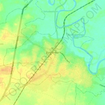
Name: Balasore topographic map, elevation, terrain.

Location: Balasore, Baleshwar (M), Baleshwar, Odisha, 75001, India (21.46171 86.88167 21.54171 86.96167)

Average elevation: 14 m

Minimum elevation: -3 m

Maximum elevation: 28 m

Gear up for your next adventure:

🧦Merino Wool Socks - Moisture-wicking comfort for long-distance hiking
💡Portable Camping Lamp - Rechargeable lamp for campsite lighting
🥾Lightweight Hiking Shoes - Comfortable shoes for day hikes
🥾Durable Hiking Shoes - Long-lasting shoes for frequent hiking
🎒Backpack Rain Cover - External shield to keep your entire pack dry

As an Amazon Associate, this site earns from qualifying purchases at no extra cost to you.