
Thank you for supporting this site ❤️
Make a donation
Make a donation
Gear up for your next adventure:
As an Amazon Associate, this site earns from qualifying purchases at no extra cost to you.
Drepung topographic map
Click on the map to display elevation.
Thank you for supporting this site ❤️
Make a donation
Make a donation
Gear up for your next adventure:
As an Amazon Associate, this site earns from qualifying purchases at no extra cost to you.
About this map
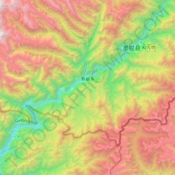
Name: Drepung topographic map, elevation, terrain.
Location: Drepung, Mêdog County, Nyingchi City, Tibet, China (29.06834 94.73490 29.37290 95.26262)
Average elevation: 2,510 m
Minimum elevation: 463 m
Maximum elevation: 5,668 m
Thank you for supporting this site ❤️
Make a donation
Make a donation
Gear up for your next adventure:
As an Amazon Associate, this site earns from qualifying purchases at no extra cost to you.