Geolocate

Keravel topographic map

Click on the map to display elevation.

About this map
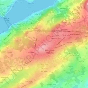
Name: Keravel topographic map, elevation, terrain.

Location: Keravel, Plougastel-Daoulas, Brest, Finistère, Bretagne, France métropolitaine, 29470, France (48.35760 -4.39371 48.39760 -4.35371)

Average elevation: 67 m

Minimum elevation: 0 m

Maximum elevation: 129 m

Other topographic maps

Click on a map to view its topography, its elevation and its terrain.

Gear up for your next adventure:

🧊Portable Cooler - Keep food and drinks cold during outdoor adventures
🛌Down Sleeping Bag - Superior warmth-to-weight ratio for cold nights
🔭Compact Monocular - One-handed bird watching and trail spotting
🥾All-Terrain Hiking Boots - Versatile boots for varied hiking conditions
👟Trail Running Shoes - Agile footwear for fast-paced topographic exploration

As an Amazon Associate, this site earns from qualifying purchases at no extra cost to you.