Geolocate

Les Ventetes topographic map

Click on the map to display elevation.

About this map

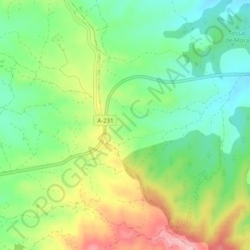
Name: Les Ventetes topographic map, elevation, terrain.

Location: Les Ventetes, Cretas, Matarraña, Teruel, Aragón, 44580, España (40.87837 0.19377 40.89837 0.21377)

Average elevation: 592 m

Minimum elevation: 528 m

Maximum elevation: 691 m

Gear up for your next adventure:

🥫Freeze-Dried Meals - Lightweight, high-calorie nutrition for multi-day treks
🧥Ultralight Puffy Jacket - Maximum warmth that packs down to the size of an orange
🧥Waterproof Hiking Jacket - Protect yourself from rain and wind while hiking
🛁Quick-Dry Microfiber Towel - Space-saving towel that dries rapidly on the move
🧰Emergency Multi-Tool - Compact multi-tool for outdoor survival

As an Amazon Associate, this site earns from qualifying purchases at no extra cost to you.