Geolocate

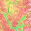
Bogros topographic map

Click on the map to display elevation.

About this map

Name: Bogros topographic map, elevation, terrain.

Location: Bogros, Messeix, Riom, Puy-de-Dôme, Auvergne-Rhône-Alpes, France métropolitaine, 63750, France (45.59571 2.55673 45.63571 2.59673)

Average elevation: 777 m

Minimum elevation: 607 m

Maximum elevation: 858 m

Other topographic maps

Click on a map to view its topography, its elevation and its terrain.
63750

France > Auvergne-Rhône-Alpes > Puy-de-Dôme > Messeix

Average elevation: 733 m

Gear up for your next adventure:

🧼Biodegradable Camp Soap - Environmentally friendly cleaning for gear and body
🥘Camping Cookware Set - Compact nesting pots and pans for trail cooking
🧥Insulated Jacket - Keep warm in cold outdoor conditions
🧢Outdoor Visor - Breathable visor for sunny hikes
💧Collapsible Water Bottle - Space-saving water bottle for outdoor activities

As an Amazon Associate, this site earns from qualifying purchases at no extra cost to you.