Geolocate

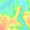
Les Closerons topographic map

Click on the map to display elevation.

About this map

Name: Les Closerons topographic map, elevation, terrain.

Location: Les Closerons, Saint-Sauveur-le-Vicomte, Cherbourg, Manche, Normandie, France métropolitaine, 50390, France (49.36759 -1.55670 49.40759 -1.51670)

Average elevation: 28 m

Minimum elevation: -1 m

Maximum elevation: 49 m

Other topographic maps

Click on a map to view its topography, its elevation and its terrain.
Gear up for your next adventure:

🩹Compact First Aid Kit - Pre-packed essentials for common trail injuries
🥘Camping Cookware Set - Compact nesting pots and pans for trail cooking
🦟Insect Repellent - Keep mosquitoes and black flies away in wooded areas
🔋Emergency Crank Radio - Weather alerts and power without needing batteries
🦯Trekking Poles - Reduced impact on joints for steep topographic climbs

As an Amazon Associate, this site earns from qualifying purchases at no extra cost to you.