Geolocate

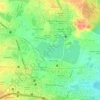
Kappala Cheruvu topographic map

Click on the map to display elevation.

About this map

Name: Kappala Cheruvu topographic map, elevation, terrain.

Location: Kappala Cheruvu, SH19, sripuram, Ward 14 BN Reddy Nagar, Greater Hyderabad Municipal Corporation East Zone, Hyderabad, Hayathnagar mandal, Rangareddy, Telangana, 500070, India (17.31346 78.56905 17.31610 78.57108)

Average elevation: 537 m

Minimum elevation: 519 m

Maximum elevation: 562 m

Other topographic maps

Click on a map to view its topography, its elevation and its terrain.
Ward 104 Kondapur

India > Telangana > Hyderabad

Average elevation: 582 m

Amber cheruvu

India > Telangana > Hyderabad

Average elevation: 590 m

Gear up for your next adventure:

🧥Thermal Fleece Jacket - Versatile insulation for changing mountain temperatures
🦶Hiking Shoe Insoles - Added support for high arches and long days on feet
🎒Hiking Backpack - Lightweight and ergonomic backpacks for day hikes or multi-day treks
🔥Emergency Fire Starter - Reliable ignition source for all weather conditions
❄️Traction Ice Cleats - Slip-on spikes for icy trails and winter hiking

As an Amazon Associate, this site earns from qualifying purchases at no extra cost to you.