Geolocate

North Naples topographic map

Click on the map to display elevation.

About this map

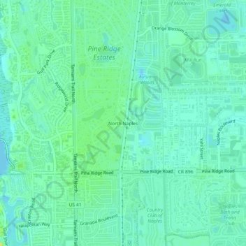
Name: North Naples topographic map, elevation, terrain.

Location: North Naples, Collier County, Florida, 35105, United States (26.19925 -81.81175 26.23925 -81.77175)

Average elevation: 7 m

Minimum elevation: -1 m

Maximum elevation: 20 m

Other topographic maps

Click on a map to view its topography, its elevation and its terrain.

Pine Ridge

United States > Florida > Collier County

Average elevation: 7 m

Orangetree

United States > Florida > Collier County

Average elevation: 6 m

Gear up for your next adventure:

🧥Packable Rain Jacket - Breathable waterproof layer for unpredictable weather
Tent Footprint - Protect tent floor and increase durability
Camping Tent - Weather-resistant tents suitable for 2 to 6 people
🔦LED Headlamp - Hands-free lighting for early morning starts or late finishes
🎒Backpack Rain Cover - External shield to keep your entire pack dry

As an Amazon Associate, this site earns from qualifying purchases at no extra cost to you.