Geolocate

Km. 50 topographic map

Click on the map to display elevation.

About this map

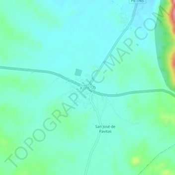
Name: Km. 50 topographic map, elevation, terrain.

Location: Km. 50, Chulucanas, Morropón, Piura, Perú (-5.18982 -80.20571 -5.14982 -80.16571)

Average elevation: 119 m

Minimum elevation: 96 m

Maximum elevation: 212 m

Gear up for your next adventure:

🧥Waterproof Jacket - Lightweight rain jackets for hiking and outdoor activities
Camping Tent - Weather-resistant tents suitable for 2 to 6 people
🧰Multitool Knife - Compact and versatile tool for outdoor use
🧢Sun Hat - Wide-brim hat for sun protection
🥾Trail Running Boots - Durable shoes designed for trail running

As an Amazon Associate, this site earns from qualifying purchases at no extra cost to you.