
Thank you for supporting this site ❤️
Make a donation
Make a donation
Gear up for your next adventure:
As an Amazon Associate, this site earns from qualifying purchases at no extra cost to you.
Rugin topographic map
Click on the map to display elevation.
Thank you for supporting this site ❤️
Make a donation
Make a donation
Gear up for your next adventure:
As an Amazon Associate, this site earns from qualifying purchases at no extra cost to you.
About this map
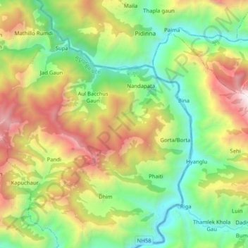
Name: Rugin topographic map, elevation, terrain.
Location: Rugin, Himali, Bajura, Sudurpashchim Pradesh, Nepal (29.52886 81.64097 29.61990 81.79860)
Average elevation: 2,074 m
Minimum elevation: 1,095 m
Maximum elevation: 3,783 m
Thank you for supporting this site ❤️
Make a donation
Make a donation
Gear up for your next adventure:
As an Amazon Associate, this site earns from qualifying purchases at no extra cost to you.