Geolocate

Kangakipur topographic map

Click on the map to display elevation.

About this map

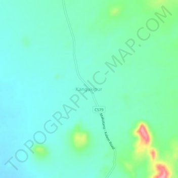
Name: Kangakipur topographic map, elevation, terrain.

Location: Kangakipur, Turkana County, Kenya (4.01371 35.46384 4.05371 35.50384)

Average elevation: 697 m

Minimum elevation: 671 m

Maximum elevation: 791 m

Gear up for your next adventure:

💧Hydration Bladder - Hands-free hydration solution for long treks
🕶️Polarized Sunglasses - Reduces glare from snow and water at high elevations
🥾Hiking Gaiters - Protect legs and shoes from mud, snow, and debris
🦶Anti-Blister Balm - Prevents friction and hotspots during long ascents
🔦LED Flashlight - Powerful and long-lasting flashlight for camping and emergencies

As an Amazon Associate, this site earns from qualifying purchases at no extra cost to you.