
Lac-Mégantic topographic map
Interactive map
Click on the map to display elevation.
About this map
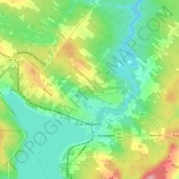
Name: Lac-Mégantic topographic map, elevation, terrain.
Location: Lac-Mégantic, Le Granit, Estrie, Quebec, Canada (45.56271 -70.94362 45.61825 -70.84427)
Average elevation: 434 m
Minimum elevation: 380 m
Maximum elevation: 536 m
Le Granit trails, hiking, mountain biking, running and outdoor activities
Other topographic maps
Click on a map to view its topography, its elevation and its terrain.