Geolocate

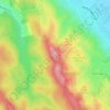
Lázi topographic map

Click on the map to display elevation.

About this map

Name: Lázi topographic map, elevation, terrain.

Location: Lázi, Pannonhalmi járás, Győr-Moson-Sopron, Transdanubia, 9089, Hungary (47.44241 17.80551 47.49259 17.86975)

Average elevation: 188 m

Minimum elevation: 164 m

Maximum elevation: 235 m

Other topographic maps

Click on a map to view its topography, its elevation and its terrain.
Danube

Hungary > Győr-Moson-Sopron

Average elevation: 119 m

Danube

Hungary > Győr-Moson-Sopron

Average elevation: 119 m

Horvátkimle

Hungary > Győr-Moson-Sopron > Kimle

Average elevation: 116 m

Gear up for your next adventure:

🦶Anti-Blister Balm - Prevents friction and hotspots during long ascents
🦌Outdoor Trail Camera - Monitor wildlife activity near your favorite spots
🧤Thermal Hiking Gloves - Grip-enhanced gloves for cold-weather altitude trekking
🧦Hiking Liner Socks - Thin base layer to prevent friction and blisters
🧴First Aid Kit - Essential first aid supplies for outdoor emergencies

As an Amazon Associate, this site earns from qualifying purchases at no extra cost to you.