Geolocate

Poblacion topographic map

Click on the map to display elevation.

About this map
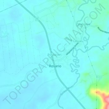
Name: Poblacion topographic map, elevation, terrain.

Location: Poblacion, Rosario, Agusan del Sur, Caraga, 8504, Philippines (8.36566 125.98160 8.40566 126.02160)

Average elevation: 32 m

Minimum elevation: 19 m

Maximum elevation: 141 m

Other topographic maps

Click on a map to view its topography, its elevation and its terrain.
Solibao River

Philippines > Agusan del Sur > Rosario

Average elevation: 24 m

Gear up for your next adventure:

⛺Lightweight Backpacking Tent - Compact tent for efficient hiking trips
🛌Insulated Sleeping Pad - Critical thermal barrier between you and the cold ground
🧣Merino Neck Gaiter - Protects against wind, sun, and cold at high altitudes
🥾Trail Running Shoes - Lightweight and durable shoes for trail running
🥫Freeze-Dried Meals - Lightweight, high-calorie nutrition for multi-day treks

As an Amazon Associate, this site earns from qualifying purchases at no extra cost to you.