
Lac Laroche topographic map
Interactive map
Click on the map to display elevation.
About this map
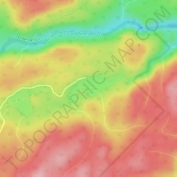
Name: Lac Laroche topographic map, elevation, terrain.
Average elevation: 164 m
Minimum elevation: 65 m
Maximum elevation: 233 m
Other topographic maps
Click on a map to view its topography, its elevation and its terrain.
Lac Girard
Canada > Québec > Port-Daniel-Gascons
Lac Girard, 1, Port-Daniel-Gascons, Le Rocher-Percé, Gaspésie–Îles-de-la-Madeleine, Québec, Canada
Average elevation: 218 m