
Bronkhorst topographic map
Interactive map
Click on the map to display elevation.
About this map
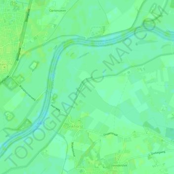
Name: Bronkhorst topographic map, elevation, terrain.
Location: Bronkhorst, Bronckhorst, Geldern, Niederlande (52.06851 6.17119 52.09788 6.22235)
Average elevation: 8 m
Minimum elevation: 2 m
Maximum elevation: 13 m
Other topographic maps
Click on a map to view its topography, its elevation and its terrain.
Bronckhorst
Niederlande > Geldern > Bronckhorst
Bronckhorst, Geldern, Niederlande
Average elevation: 13 m
Laag-Keppel
Niederlande > Geldern > Bronckhorst
Laag-Keppel, Bronckhorst, Geldern, Niederlande
Average elevation: 11 m