Geolocate

Katihar topographic map

Click on the map to display elevation.

About this map

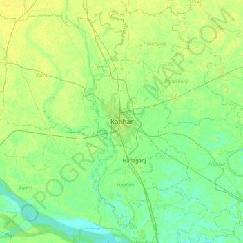
Name: Katihar topographic map, elevation, terrain.

Location: Katihar, Bihar, 854101, India (25.38338 87.40904 25.70338 87.72904)

Average elevation: 31 m

Minimum elevation: 23 m

Maximum elevation: 42 m

Gear up for your next adventure:

Lightweight Backpacking Tent - Compact tent for efficient hiking trips
🕯️Camping Lantern - Illuminates your entire campsite with high-efficiency LEDs
🧦Hiking Liner Socks - Thin base layer to prevent friction and blisters
🎒Hiking Daypack - Lightweight and durable backpacks for day trips and excursions
🧤Insulated Winter Gloves - Heavy-duty protection for sub-zero Canadian adventures

As an Amazon Associate, this site earns from qualifying purchases at no extra cost to you.