
Thank you for supporting this site ❤️
Make a donation
Make a donation
Gear up for your next adventure:
As an Amazon Associate, this site earns from qualifying purchases at no extra cost to you.
Cemel topographic map
Click on the map to display elevation.
Thank you for supporting this site ❤️
Make a donation
Make a donation
Gear up for your next adventure:
As an Amazon Associate, this site earns from qualifying purchases at no extra cost to you.
About this map
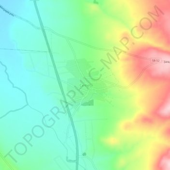
Name: Cemel topographic map, elevation, terrain.
Location: Cemel, Şarkışla, Sivas, Centraal-Anatolië, Turkije (39.29730 36.44579 39.33730 36.48579)
Average elevation: 1,330 m
Minimum elevation: 1,249 m
Maximum elevation: 1,481 m
Thank you for supporting this site ❤️
Make a donation
Make a donation
Gear up for your next adventure:
As an Amazon Associate, this site earns from qualifying purchases at no extra cost to you.