
Thank you for supporting this site ❤️
Make a donation
Make a donation
Gear up for your next adventure:
As an Amazon Associate, this site earns from qualifying purchases at no extra cost to you.
Baie-d'Hudson topographic map
Click on the map to display elevation.
Thank you for supporting this site ❤️
Make a donation
Make a donation
Gear up for your next adventure:
As an Amazon Associate, this site earns from qualifying purchases at no extra cost to you.
About this map
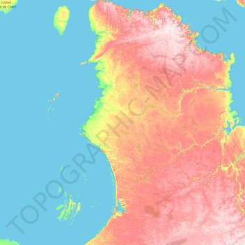
Name: Baie-d'Hudson topographic map, elevation, terrain.
Location: Baie-d'Hudson, Kativik, Nord-du-Québec, Québec, Canada (55.00000 -78.60153 62.55768 -73.74942)
Average elevation: 135 m
Minimum elevation: 0 m
Maximum elevation: 661 m
Thank you for supporting this site ❤️
Make a donation
Make a donation
Gear up for your next adventure:
As an Amazon Associate, this site earns from qualifying purchases at no extra cost to you.
Other topographic maps
Click on a map to view its topography, its elevation and its terrain.