Geolocate

Bausi topographic map

Click on the map to display elevation.

About this map

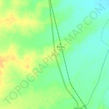
Name: Bausi topographic map, elevation, terrain.

Location: Bausi, Banka, Bihar, 813104, India (24.78223 87.00383 24.82223 87.04383)

Average elevation: 101 m

Minimum elevation: 87 m

Maximum elevation: 118 m

Gear up for your next adventure:

🥾Light Hiking Boots - Lightweight and comfortable boots for day hikes
🔦LED Headlamp - Hands-free lighting for early morning starts or late finishes
🩹Moleskin Blister Pads - Direct protection for painful foot pressure points
📷Outdoor Action Camera - Capture high-elevation views and rugged adventures
Camping Coffee Maker - Brew fresh coffee anywhere on the topographic map

As an Amazon Associate, this site earns from qualifying purchases at no extra cost to you.