
La Chourlie topographic map
Interactive map
Click on the map to display elevation.
About this map
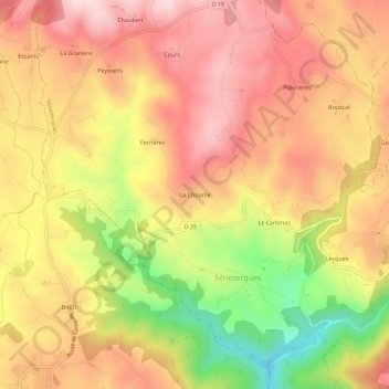
Name: La Chourlie topographic map, elevation, terrain.
Average elevation: 533 m
Minimum elevation: 299 m
Maximum elevation: 687 m
Other topographic maps
Click on a map to view its topography, its elevation and its terrain.
Ferrières
France > Auvergne-Rhône-Alpes > Cantal > Sénezergues
Ferrières, Sénezergues, Aurillac, Cantal, Auvergne-Rhône-Alpes, France métropolitaine, 15340, France
Average elevation: 556 m