

Nakhchivan topographic map
Click on the map to display elevation.
Nakhchivan
Nakhchivan (Azerbaijani: Naxçıvan [nɑxtʃɯˈvɑn]; Armenian: Նախիջևան, romanized: Nakhijevan) is the capital of the eponymous Nakhchivan Autonomous Republic of Azerbaijan, located 450 km (280 mi) west of Baku. The municipality of Nakhchivan consists of the city of Nakhchivan, the settlement of Əliabad and the villages of Başbaşı, Bulqan, Haciniyyət, Qaraçuq, Qaraxanbəyli, Tumbul, Qarağalıq, and Daşduz.[2] It is spread over the foothills of Zangezur Mountains, on the right bank of the Nakhchivan River at an altitude of 873 m (2,864 ft) above sea level.
About this map
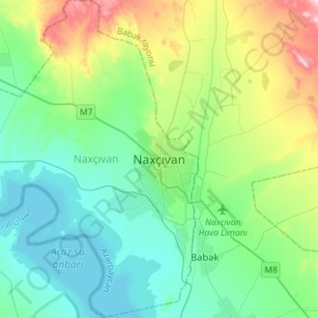
Name: Nakhchivan topographic map, elevation, terrain.
Location: Nakhchivan, Nakhichevan Autonomous Republic, Azerbaijan (39.12129 45.27191 39.31407 45.43771)
Average elevation: 886 m
Minimum elevation: 763 m
Maximum elevation: 1,272 m
Other topographic maps
Click on a map to view its topography, its elevation and its terrain.

