Geolocate

Walddorf topographic map

Click on the map to display elevation.

About this map

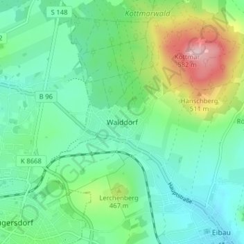
Name: Walddorf topographic map, elevation, terrain.

Location: Walddorf, Kottmar, Görlitz, Sachsen, 02739, Deutschland (50.97856 14.61910 51.01856 14.65910)

Average elevation: 416 m

Minimum elevation: 354 m

Maximum elevation: 582 m

Gear up for your next adventure:

🛏️Camping Sleeping Mat - Comfortable mats for sleeping outdoors
🧥Waterproof Hiking Jacket - Protect yourself from rain and wind while hiking
🧢Outdoor Visor - Breathable visor for sunny hikes
🧥Softshell Jacket - Windproof and breathable jacket for hiking
🍽️Titanium Camping Spork - Ultralight and indestructible eating utensil

As an Amazon Associate, this site earns from qualifying purchases at no extra cost to you.