Geolocate

Tegal Besar topographic map

Click on the map to display elevation.

About this map

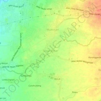
Name: Tegal Besar topographic map, elevation, terrain.

Location: Tegal Besar, Jember, East Java, Java, 68132, Indonesia (-8.22801 113.67747 -8.18801 113.71747)

Average elevation: 86 m

Minimum elevation: 61 m

Maximum elevation: 108 m

Other topographic maps

Click on a map to view its topography, its elevation and its terrain.

Watu Ulo

Indonesia > East Java > Jember > Watuulo

Average elevation: 9 m

Gear up for your next adventure:

🔭Compact Binoculars - Lightweight optics for scouting trails and wildlife
🧴First Aid Kit - Essential first aid supplies for outdoor emergencies
🥾Durable Hiking Shoes - Long-lasting shoes for frequent hiking
🥾Light Trekking Boots - Supportive boots for multi-day treks
🐕Hiking Dog Pack - Let your canine companion carry their own water and food

As an Amazon Associate, this site earns from qualifying purchases at no extra cost to you.