Geolocate

Malalim topographic map

Click on the map to display elevation.

About this map

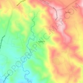
Name: Malalim topographic map, elevation, terrain.

Location: Malalim, Baras, Rizal, Calabarzon, 1970, Philippines (14.53539 121.26425 14.57539 121.30425)

Average elevation: 145 m

Minimum elevation: 11 m

Maximum elevation: 278 m

Gear up for your next adventure:

🧥Waterproof Jacket - Lightweight rain jackets for hiking and outdoor activities
🧥Waterproof Hiking Jacket - Protect yourself from rain and wind while hiking
🏃Hydration Running Vest - Carry water and maps close to your body for speed
🚲MTB Frame Bag - Carry tools and maps directly on your bicycle frame
🥾Mountain Hiking Shoes - Shoes with superior grip for mountainous terrain

As an Amazon Associate, this site earns from qualifying purchases at no extra cost to you.