
Thank you for supporting this site ❤️
Make a donation
Make a donation
Gear up for your next adventure:
As an Amazon Associate, this site earns from qualifying purchases at no extra cost to you.
Sant'Albano topographic map
Click on the map to display elevation.
Thank you for supporting this site ❤️
Make a donation
Make a donation
Gear up for your next adventure:
As an Amazon Associate, this site earns from qualifying purchases at no extra cost to you.
About this map
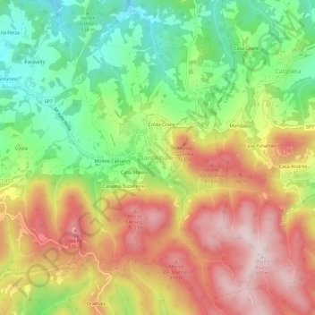
Name: Sant'Albano topographic map, elevation, terrain.
Location: Sant'Albano, Val di Nizza, Pavia, Lombardia, 27050, Italia (44.84930 9.18184 44.88930 9.22184)
Average elevation: 626 m
Minimum elevation: 407 m
Maximum elevation: 859 m
Thank you for supporting this site ❤️
Make a donation
Make a donation
Gear up for your next adventure:
As an Amazon Associate, this site earns from qualifying purchases at no extra cost to you.