
Thank you for supporting this site ❤️
Make a donation
Make a donation
Gear up for your next adventure:
As an Amazon Associate, this site earns from qualifying purchases at no extra cost to you.
Gausac topographic map
Click on the map to display elevation.
Thank you for supporting this site ❤️
Make a donation
Make a donation
Gear up for your next adventure:
As an Amazon Associate, this site earns from qualifying purchases at no extra cost to you.
About this map
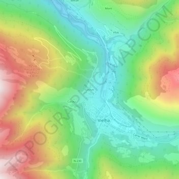
Name: Gausac topographic map, elevation, terrain.
Location: Gausac, Viella, Val-d'Aran, Lérida, Catalogne, 25530, Espagne (42.68866 0.77118 42.72866 0.81118)
Average elevation: 1,291 m
Minimum elevation: 899 m
Maximum elevation: 1,933 m
Thank you for supporting this site ❤️
Make a donation
Make a donation
Gear up for your next adventure:
As an Amazon Associate, this site earns from qualifying purchases at no extra cost to you.