Geolocate

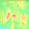
St. John topographic map

Click on the map to display elevation.

About this map

Name: St. John topographic map, elevation, terrain.

Location: St. John, Rolette County, North Dakota, United States (48.93561 -99.71755 48.95013 -99.70362)

Average elevation: 597 m

Minimum elevation: 573 m

Maximum elevation: 633 m

Other topographic maps

Click on a map to view its topography, its elevation and its terrain.
Gear up for your next adventure:

🏕️Camping Hammock - Integrated protection for sleeping between trees
🧭GPS Outdoor Watch - Smart watch for navigation and fitness tracking in nature
⛺Camping Tent - Weather-resistant tents suitable for 2 to 6 people
🎒Hiking Daypack - Lightweight and durable backpacks for day trips and excursions
🥾Hiking Boots - Sturdy boots providing ankle support and traction on rugged trails

As an Amazon Associate, this site earns from qualifying purchases at no extra cost to you.