Geolocate

Noche topographic map

Click on the map to display elevation.

About this map

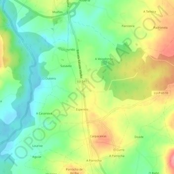
Name: Noche topographic map, elevation, terrain.

Location: Noche, Vilalba, Tierra Chá, Lugo, Galicia, España (43.24793 -7.69597 43.27569 -7.64549)

Average elevation: 446 m

Minimum elevation: 404 m

Maximum elevation: 504 m

Other topographic maps

Click on a map to view its topography, its elevation and its terrain.

Belesar

España > Galicia > Tierra Chá > Vilalba

Average elevation: 471 m

Gear up for your next adventure:

📷Outdoor Action Camera - Capture high-elevation views and rugged adventures
🛶Canoe Life Vest - Safety vest for water sports
🦯Trekking Poles - Reduced impact on joints for steep topographic climbs
🧢Outdoor Visor - Breathable visor for sunny hikes
🧼Travel Hand Sanitizer - Keep hands clean when water is scarce

As an Amazon Associate, this site earns from qualifying purchases at no extra cost to you.