Geolocate

Comuna 1 topographic map

Click on the map to display elevation.

About this map

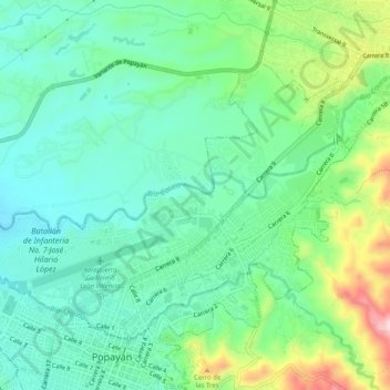
Name: Comuna 1 topographic map, elevation, terrain.

Location: Comuna 1, Popayán, Centro, Cauca, Pacífica, Colombia (2.44588 -76.62767 2.48045 -76.57703)

Average elevation: 1,760 m

Minimum elevation: 1,686 m

Maximum elevation: 1,946 m

Other topographic maps

Click on a map to view its topography, its elevation and its terrain.

Toscana Circle

Colombia > Cauca > Popayán

Average elevation: 1,735 m

Gear up for your next adventure:

🔦UV Flashlight - Detect minerals or specific insects in the dark
🔨Vehicle Emergency Tool - Safety tool for remote road trips to trailheads
🛶Kayak Dry Bag - Waterproof storage for kayaking adventures
🎒Backpack Rain Cover - External shield to keep your entire pack dry
🗺️Topographic Maps - Detailed maps to explore trails, mountains, and wilderness areas

As an Amazon Associate, this site earns from qualifying purchases at no extra cost to you.