
Make a donation
Gear up for your next adventure:
As an Amazon Associate, this site earns from qualifying purchases at no extra cost to you.
Gildehaus topographic map
Click on the map to display elevation.
Make a donation
Gear up for your next adventure:
As an Amazon Associate, this site earns from qualifying purchases at no extra cost to you.
Gildehaus
Gildehaus ist ein Ortsteil der Stadt Bad Bentheim in Niedersachsen (Deutschland) und liegt im Landkreis Grafschaft Bentheim an den Grenzen zu Nordrhein-Westfalen und den Niederlanden. Das Dorf Gildehaus, auf zwei Höhenrücken (Ausläufer Teutoburger Wald) gelegen und heute staatlich anerkannter Erholungsort, trägt seit 1923 den Beinamen „Perle der Grafschaft“.
Make a donation
Gear up for your next adventure:
As an Amazon Associate, this site earns from qualifying purchases at no extra cost to you.
About this map
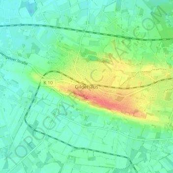
Name: Gildehaus topographic map, elevation, terrain.
Average elevation: 45 m
Minimum elevation: 29 m
Maximum elevation: 80 m
Make a donation
Gear up for your next adventure:
As an Amazon Associate, this site earns from qualifying purchases at no extra cost to you.
Other topographic maps
Click on a map to view its topography, its elevation and its terrain.
Kronenburg
Deutschland > Niedersachsen > Landkreis Grafschaft Bentheim > Bad Bentheim
Die Burg Bentheim ist eine Höhenburg in Bad Bentheim im Landkreis Grafschaft Bentheim in Niedersachsen (Deutschland), deren Bau im Frühen Mittelalter begann. Sie gilt als eine der größten und schönsten Burganlagen Nordwestdeutschlands und ist das Wahrzeichen der Stadt Bad Bentheim. Erste Erwähnungen…
Average elevation: 52 m