
Ghat topographic map
Interactive map
Click on the map to display elevation.
About this map
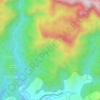
Name: Ghat topographic map, elevation, terrain.
Location: Ghat, Sihunta, Chamba district, Himachal Pradesh, 176206, Inde (32.23331 76.14263 32.27331 76.18263)
Average elevation: 1,012 m
Minimum elevation: 725 m
Maximum elevation: 1,526 m