Geolocate

Salina topographic map

Click on the map to display elevation.

About this map

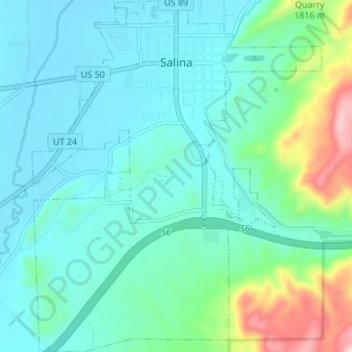
Name: Salina topographic map, elevation, terrain.

Location: Salina, Sevier County, Utah, United States (38.91446 -111.88771 38.96698 -111.83202)

Average elevation: 1,637 m

Minimum elevation: 1,560 m

Maximum elevation: 1,956 m

Other topographic maps

Click on a map to view its topography, its elevation and its terrain.

Monroe Peak

United States > Utah > Sevier County

Average elevation: 3,140 m

Sawtooth

United States > Utah > Sevier County

Average elevation: 2,069 m

Austin

United States > Utah > Sevier County

Average elevation: 1,624 m

Gear up for your next adventure:

🥽Outdoor Goggles - Protective eyewear for outdoor activities
🥾Trekking Boots - Durable boots for long-distance trekking
❄️Traction Ice Cleats - Slip-on spikes for icy trails and winter hiking
🥾Waterproof Hiking Boots - Boots keeping your feet dry in wet conditions
🧦Thermal Socks - Warm socks for winter hiking or camping

As an Amazon Associate, this site earns from qualifying purchases at no extra cost to you.