
Thank you for supporting this site ❤️
Make a donation
Make a donation
Gear up for your next adventure:
As an Amazon Associate, this site earns from qualifying purchases at no extra cost to you.
Saqués topographic map
Click on the map to display elevation.
Thank you for supporting this site ❤️
Make a donation
Make a donation
Gear up for your next adventure:
As an Amazon Associate, this site earns from qualifying purchases at no extra cost to you.
About this map
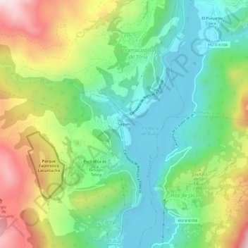
Name: Saqués topographic map, elevation, terrain.
Location: Saqués, Biescas, Alto Gállego, Huesca, Aragón, 22665, España (42.68248 -0.33933 42.72248 -0.29933)
Average elevation: 1,295 m
Minimum elevation: 1,049 m
Maximum elevation: 1,734 m
Thank you for supporting this site ❤️
Make a donation
Make a donation
Gear up for your next adventure:
As an Amazon Associate, this site earns from qualifying purchases at no extra cost to you.