Geolocate

Lee Point topographic map

Click on the map to display elevation.

About this map

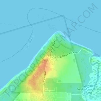
Name: Lee Point topographic map, elevation, terrain.

Location: Lee Point, City of Darwin, Northern Territory, Australia (-12.35111 130.87012 -12.32156 130.90602)

Average elevation: 7 m

Minimum elevation: -1 m

Maximum elevation: 38 m

Other topographic maps

Click on a map to view its topography, its elevation and its terrain.

Darwin

Australia > City of Darwin

Average elevation: 8 m

Darwin

Australia > City of Darwin

Average elevation: 8 m

Darwin

Australia > City of Darwin

Average elevation: 8 m

Darwin

Australia > City of Darwin

Average elevation: 8 m

Darwin

Australia > City of Darwin

Average elevation: 8 m

Darwin

Australia > City of Darwin

Average elevation: 8 m

Gear up for your next adventure:

🥤Collapsible Travel Cup - Saves space and weight in your mess kit
🥾Approach Boots - Comfortable boots for hiking and climbing approaches
🔭Compact Binoculars - Lightweight optics for scouting trails and wildlife
🗺️Topographic Maps - Detailed maps to explore trails, mountains, and wilderness areas
🧢Outdoor Visor - Breathable visor for sunny hikes

As an Amazon Associate, this site earns from qualifying purchases at no extra cost to you.