Geolocate

Cela Velha topographic map

Click on the map to display elevation.

About this map

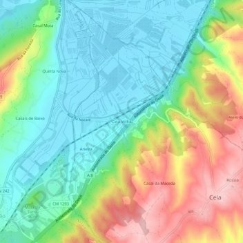
Name: Cela Velha topographic map, elevation, terrain.

Location: Cela Velha, Cela, Alcobaça, Leiria, 2450-015, Portugal (39.53235 -9.07550 39.57235 -9.03550)

Average elevation: 66 m

Minimum elevation: -1 m

Maximum elevation: 185 m

Gear up for your next adventure:

🧭Orienteering Kit - Tools for map reading and navigation in the wild
🍽️Titanium Camping Spork - Ultralight and indestructible eating utensil
🎒Hiking Daypack - Lightweight and durable backpacks for day trips and excursions
🥾Mountain Hiking Boots - High-traction boots for rocky terrain
🩹Moleskin Blister Pads - Direct protection for painful foot pressure points

As an Amazon Associate, this site earns from qualifying purchases at no extra cost to you.