Geolocate

Pleasant topographic map

Click on the map to display elevation.

About this map

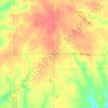
Name: Pleasant topographic map, elevation, terrain.

Location: Pleasant, Switzerland County, Indiana, 47224, United States (38.85089 -85.20384 38.89089 -85.16384)

Average elevation: 282 m

Minimum elevation: 241 m

Maximum elevation: 301 m

Other topographic maps

Click on a map to view its topography, its elevation and its terrain.

Patriot

United States > Indiana > Switzerland County

Average elevation: 169 m

Vevay

United States > Indiana > Switzerland County

Average elevation: 164 m

Gear up for your next adventure:

🧦Crew Hiking Socks - Comfortable socks for long-distance hikes
Backpacking Tent - Lightweight tent for long-distance hiking trips
🧦Outdoor Socks - Durable socks designed for hiking and outdoor sports
Camping Tent - Weather-resistant tents suitable for 2 to 6 people
🥫Freeze-Dried Meals - Lightweight, high-calorie nutrition for multi-day treks

As an Amazon Associate, this site earns from qualifying purchases at no extra cost to you.