Geolocate

Bidholi topographic map

Click on the map to display elevation.

About this map

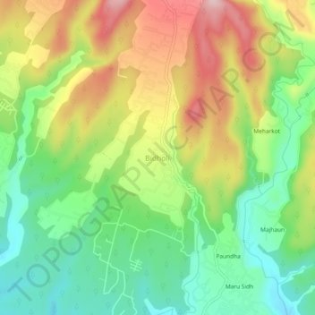
Name: Bidholi topographic map, elevation, terrain.

Location: Bidholi, Vikasnagar, Dehradun, Uttarakhand, 248007, India (30.37043 77.94750 30.41043 77.98750)

Average elevation: 736 m

Minimum elevation: 634 m

Maximum elevation: 872 m

Gear up for your next adventure:

🥾Hiking Boots - Sturdy boots providing ankle support and traction on rugged trails
🥾Light Trekking Boots - Supportive boots for multi-day treks
🧣Merino Neck Gaiter - Protects against wind, sun, and cold at high altitudes
🌬️Windproof Camp Stove - Efficient cooking even on exposed mountain peaks
Tent Footprint - Protect tent floor and increase durability

As an Amazon Associate, this site earns from qualifying purchases at no extra cost to you.