Geolocate

Carac-an River topographic map

Click on the map to display elevation.

About this map

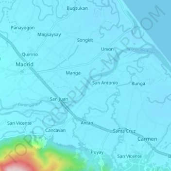
Name: Carac-an River topographic map, elevation, terrain.

Location: Carac-an River, Cancavan, Surigao del Sur, Caraga, Philippines (9.23750 125.95320 9.26817 126.02482)

Average elevation: 23 m

Minimum elevation: -2 m

Maximum elevation: 407 m

Gear up for your next adventure:

🥾Approach Shoes - Shoes designed for climbing approaches and rugged trails
🌡️Emergency Mylar Blankets - Compact thermal protection for unexpected nights outdoors
🧴Insect Repellent - Protect yourself from bugs during outdoor adventures
🔦LED Headlamp - Hands-free lighting for early morning starts or late finishes
🛶Kayak Accessories - Essential gear for safe and fun kayaking adventures

As an Amazon Associate, this site earns from qualifying purchases at no extra cost to you.