Geolocate

Altenstadt topographic map

Click on the map to display elevation.

About this map
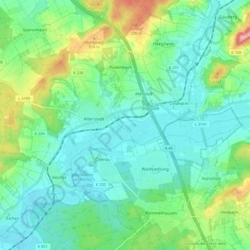
Name: Altenstadt topographic map, elevation, terrain.

Location: Altenstadt, Wetteraukreis, Hesse, 63674, Germany (50.25353 8.89792 50.31559 9.00823)

Average elevation: 153 m

Minimum elevation: 114 m

Maximum elevation: 267 m

Other topographic maps

Click on a map to view its topography, its elevation and its terrain.

Der Haag

Germany > Hesse > Wetteraukreis > Melbach

Average elevation: 155 m

Kreischberg

Germany > Hesse > Wetteraukreis > Büdingen

Average elevation: 213 m

Gear up for your next adventure:

🧢Hiking Hat - Sun-protective and breathable hats for long treks
🧥Softshell Hiking Jacket - The perfect balance of wind protection and breathability
💡LED Headlamp - Hands-free illumination for night hiking and camping
🥤Collapsible Travel Cup - Saves space and weight in your mess kit
🔭Compact Monocular - One-handed bird watching and trail spotting

As an Amazon Associate, this site earns from qualifying purchases at no extra cost to you.