
Tân An topographic map
Interactive map
Click on the map to display elevation.
About this map
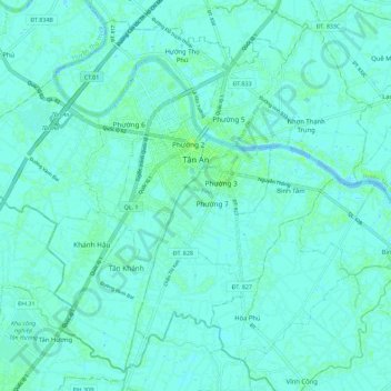
Name: Tân An topographic map, elevation, terrain.
Location: Tân An, Tỉnh Long An, 0272, Viêt Nam (10.47616 106.34707 10.57572 106.46036)
Average elevation: 3 m
Minimum elevation: -1 m
Maximum elevation: 9 m