
Iringa topographic map
Click on the map to display elevation.
About this map
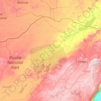
Name: Iringa topographic map, elevation, terrain.
Location: Iringa, Iringa Region, Southern Highlands Zone, Tanzania (-8.24409 34.19411 -6.88860 36.20176)
Average elevation: 1,215 m
Minimum elevation: 258 m
Maximum elevation: 2,310 m