
Trub topographic map
Click on the map to display elevation.
About this map
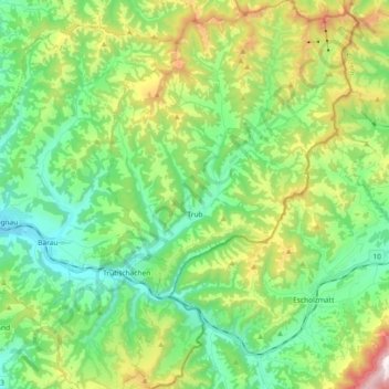
Name: Trub topographic map, elevation, terrain.
Average elevation: 990 m
Minimum elevation: 674 m
Maximum elevation: 1,720 m
Other topographic maps
Click on a map to view its topography, its elevation and its terrain.
Vilbringen
Switzerland > Bern > Emmental administrative district > Kirchberg (BE)
Average elevation: 529 m
Hinter Spitzenegg
Switzerland > Bern > Emmental administrative district > Langnau im Emmental > Obeningohl
Average elevation: 948 m