
Make a donation
Gear up for your next adventure:
As an Amazon Associate, this site earns from qualifying purchases at no extra cost to you.
Woodward Park topographic map
Click on the map to display elevation.
Make a donation
Gear up for your next adventure:
As an Amazon Associate, this site earns from qualifying purchases at no extra cost to you.
About this map
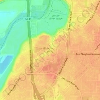
Name: Woodward Park topographic map, elevation, terrain.
Average elevation: 103 m
Minimum elevation: 74 m
Maximum elevation: 118 m
Make a donation
Gear up for your next adventure:
As an Amazon Associate, this site earns from qualifying purchases at no extra cost to you.
Other topographic maps
Click on a map to view its topography, its elevation and its terrain.
Pinedale
United States > California > Fresno County > Fresno
Pinedale is a previously unincorporated community in Fresno County, California. It lies at an elevation of 348 feet (106 m). It was once a rural community located on the Southern Pacific Railroad 3.5 miles (5.6 km) north-northwest of Clovis but has since become surrounded and annexed by the city of Fresno.…
Average elevation: 107 m