Geolocate

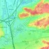
Tremelo topographic map

Click on the map to display elevation.

About this map

Name: Tremelo topographic map, elevation, terrain.

Location: Tremelo, Leuven, Flemish Brabant, Flanders, Belgium (50.97917 4.65286 51.02684 4.77431)

Average elevation: 11 m

Minimum elevation: 3 m

Maximum elevation: 56 m

Other topographic maps

Click on a map to view its topography, its elevation and its terrain.
Leuven

Belgium > Flemish Brabant > Leuven > Leuven

Average elevation: 50 m

Bos

Belgium > Flemish Brabant > Leuven > Zoutleeuw

Average elevation: 31 m

Orsmaal

Belgium > Flemish Brabant > Leuven

Average elevation: 44 m

Optielt

Belgium > Flemish Brabant > Leuven > Tielt

Average elevation: 51 m

Butsel

Belgium > Flemish Brabant > Leuven > Boutersem

Average elevation: 66 m

Beneden-Kessel

Belgium > Flemish Brabant > Leuven > Leuven > Kessel-Lo

Average elevation: 34 m

Ourodenberg

Belgium > Flemish Brabant > Leuven > Aarschot

Average elevation: 16 m

Stadspark

Belgium > Flemish Brabant > Leuven > Aarschot

Average elevation: 24 m

Gear up for your next adventure:

🥾Mountain Hiking Boots - High-traction boots for rocky terrain
🛌Insulated Sleeping Pad - Critical thermal barrier between you and the cold ground
🥾Approach Boots - Comfortable boots for hiking and climbing approaches
🛶Kayak Dry Bag - Waterproof storage for kayaking adventures
🗺️Topographic Maps - Detailed maps to explore trails, mountains, and wilderness areas

As an Amazon Associate, this site earns from qualifying purchases at no extra cost to you.