
Thank you for supporting this site ❤️
Make a donation
Make a donation
Gear up for your next adventure:
As an Amazon Associate, this site earns from qualifying purchases at no extra cost to you.
Gardunha topographic map
Click on the map to display elevation.
Thank you for supporting this site ❤️
Make a donation
Make a donation
Gear up for your next adventure:
As an Amazon Associate, this site earns from qualifying purchases at no extra cost to you.
About this map
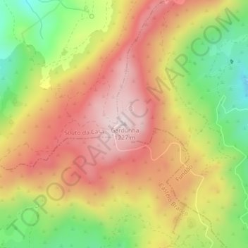
Name: Gardunha topographic map, elevation, terrain.
Location: Gardunha, São Vicente da Beira, Castelo Branco, Portugal (40.08054 -7.52506 40.08064 -7.52496)
Average elevation: 1,015 m
Minimum elevation: 766 m
Maximum elevation: 1,219 m
Thank you for supporting this site ❤️
Make a donation
Make a donation
Gear up for your next adventure:
As an Amazon Associate, this site earns from qualifying purchases at no extra cost to you.