
Thank you for supporting this site ❤️
Make a donation
Make a donation
Gear up for your next adventure:
As an Amazon Associate, this site earns from qualifying purchases at no extra cost to you.
Thelepte topographic map
Click on the map to display elevation.
Thank you for supporting this site ❤️
Make a donation
Make a donation
Gear up for your next adventure:
As an Amazon Associate, this site earns from qualifying purchases at no extra cost to you.
About this map
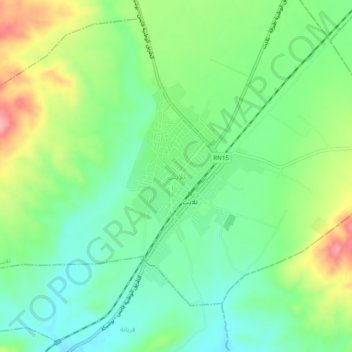
Name: Thelepte topographic map, elevation, terrain.
Location: Thelepte, تلابت, معتمدية فريانة, Kasserine, 1215, Tunisia (34.95750 8.57340 34.99750 8.61340)
Average elevation: 799 m
Minimum elevation: 755 m
Maximum elevation: 880 m
Thank you for supporting this site ❤️
Make a donation
Make a donation
Gear up for your next adventure:
As an Amazon Associate, this site earns from qualifying purchases at no extra cost to you.