Geolocate

Bramford topographic map

Click on the map to display elevation.

About this map
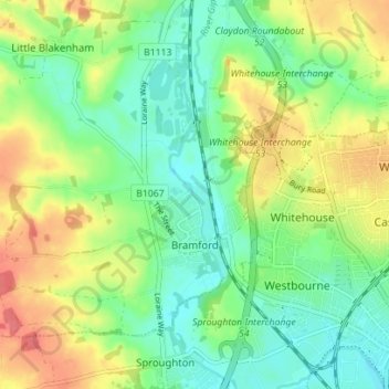
Name: Bramford topographic map, elevation, terrain.

Location: Bramford, Mid Suffolk, Suffolk, England, United Kingdom (52.06514 1.04381 52.09686 1.11373)

Average elevation: 26 m

Minimum elevation: 2 m

Maximum elevation: 62 m

Gear up for your next adventure:

🧥Waterproof Pants - Keep dry during rainy hiking conditions
⛺Tent Footprint - Protect tent floor and increase durability
🔦LED Headtorch - Bright and durable light for night activities
🧢Sun Protection Cap - Breathable cap to protect from sun exposure
⛺Backpacking Tent - Lightweight tent for long-distance hiking trips

As an Amazon Associate, this site earns from qualifying purchases at no extra cost to you.