Geolocate

Santa Rita topographic map

Click on the map to display elevation.

About this map

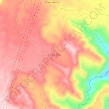
Name: Santa Rita topographic map, elevation, terrain.

Location: Santa Rita, Xicotepec, Puebla, Mexico (20.34306 -97.83417 20.38306 -97.79417)

Average elevation: 499 m

Minimum elevation: 293 m

Maximum elevation: 596 m

Gear up for your next adventure:

🧦Thermal Socks - Warm socks for winter hiking or camping
🔋Solar Power Bank - Keep your GPS and devices charged during long outdoor trips
🧤Insulated Winter Gloves - Heavy-duty protection for sub-zero Canadian adventures
🧦Hiking Liner Socks - Thin base layer to prevent friction and blisters
🥾Hiking Boots - Sturdy boots providing ankle support and traction on rugged trails

As an Amazon Associate, this site earns from qualifying purchases at no extra cost to you.